By scanning the site and then doing the drafting and designing portion from the point cloud data, we’re able to have one hundred percent fabrication done before the project even begins.
Upgrading or retrofitting your terminal operations requires careful planning, engineering and design. But even the most meticulous process carries risks. Engineering and fabrication drawings are only as good as the data used to create them, so if the drawings and models are based on inaccurate or incomplete as-built information, clashes and rework can lead to costly delays and production losses.


Location
Calgary, Alberta, Canada

Fortunately, there is a way to mitigate errors and problems before they occur. As the oil and gas industry drives toward maximum efficiency, 3D laser scanning is becoming the standard approach for capturing accurate, comprehensive as-built data that transforms the design and fabrication process.
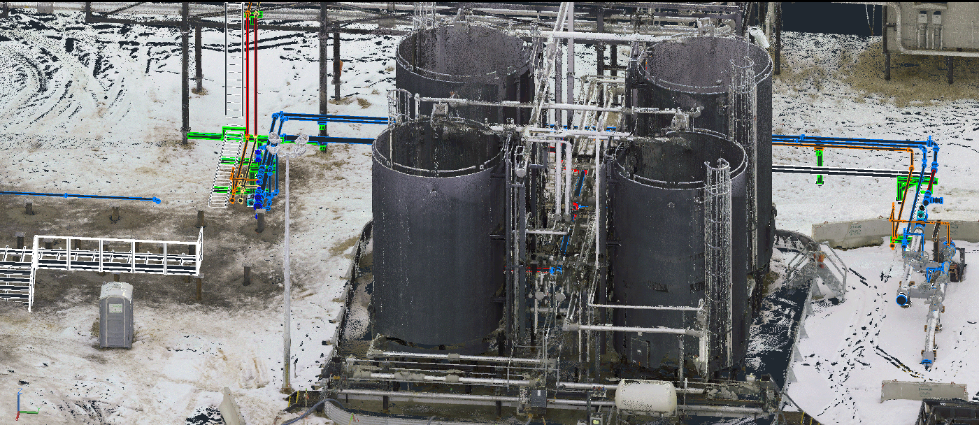
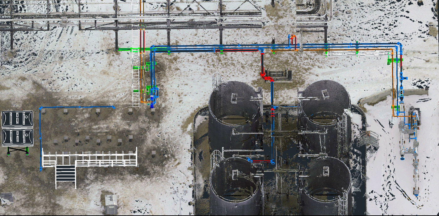
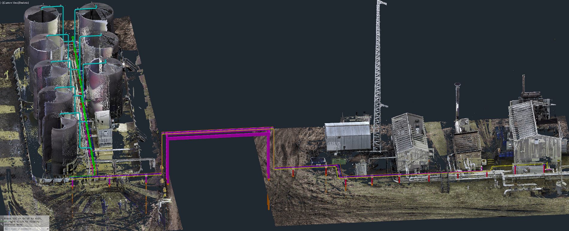
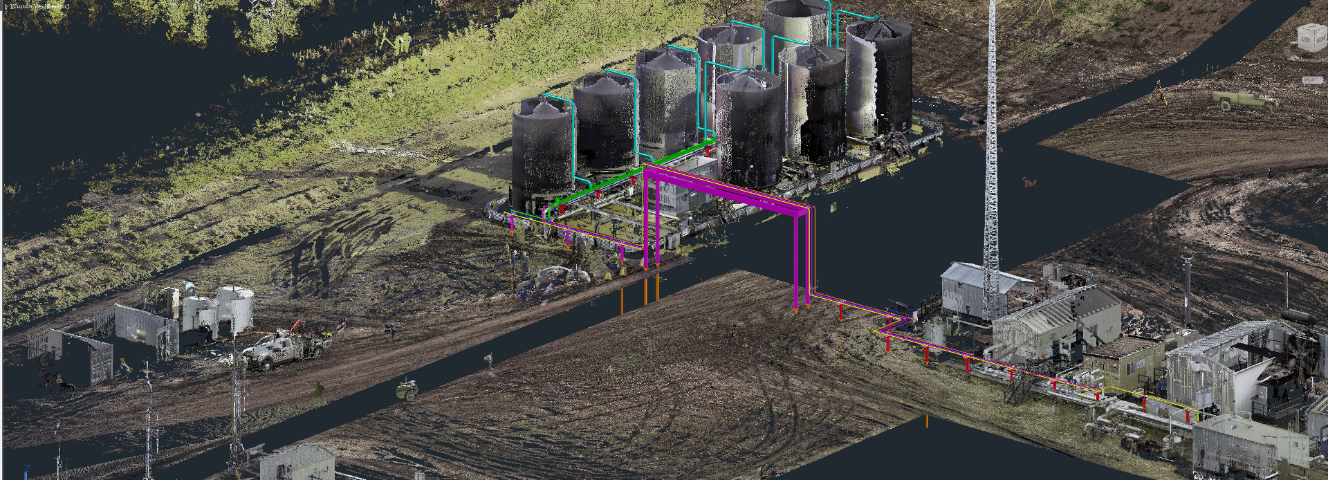
A noncontact and nondestructive method of digitally capturing physical objects in 3D using a beam of light, or laser, 3D laser scanning produces a comprehensive set of measurement points known as a point cloud. Within the past several years, laser scanners have been developed that make it possible to capture a complete, clean, accurate 3D point cloud with high-dynamic-range imagery in less than two minutes. (Scans without imagery can be completed in as little as 28 seconds.) Software advances have made working with point clouds fast and easy, even when integrating point cloud data into existing CAD workflows. (Related: Watch how laser scanning enables a true digital twin.)
Instead of donning harnesses, climbing ladders, or erecting and balancing on scaffolding, personnel can quickly capture all the data they need from safe locations on the ground. Importantly, the accuracy and completeness of the data virtually eliminates rework and ensures perfect-fit fabrication on every project.
“By scanning the site and then doing the drafting and designing portion from the point cloud data, we’re able to have one hundred percent fabrication done before the project even begins,” says Zachary McNeil, owner of Proport Pipefitting Inc., based in Grande Prairie, Alberta, Canada. “Facility construction is much safer, faster and easier with this approach, and it provides a cost savings for all involved.”
There's a significant amount of risk reduction. There's no more need to go back and forth with emails and requests for information (RFIs) because laser scanning provides a vivid picture of what’s there and why the design needs to be handled a certain way.
One Scan, Multiple Benefits
With demand for oil and gas production continuing to rise, the safety and speed enabled by 3D laser scanning are essential in facility construction and retrofits. In Western Canada, McNeil says, many oil and gas producers won’t even allow engineering and construction firms to bid on certain projects unless they use laser scanning. “People recognize how much money it’s saving, especially in terms of rework, because we’re able to tell them exactly what they need and where it needs to go,” he says. “There’s a significant amount of risk reduction. There’s no more need to go back and forth with emails and requests for information (RFIs) because laser scanning provides a vivid picture of what’s there and why the design needs to be handled a certain way.”
The need for 3D laser scanning is so great that McNeil has transitioned away from physical pipefitting to focus exclusively on the virtual side of the process, providing scanning and drafting services for engineering and construction firms throughout the region. His high-quality, seamless workflow allows him to quickly capture as-built conditions and rapidly deliver 2D and 3D models and flythroughs that enable accurate fabrication and precise installation of even tight-fitting, complex piping work.
“As soon as people see the deliverables, they immediately recognize the value in laser scanning,” McNeil says.
While the primary benefit is having accurate, comprehensive as-built data of the facility—a core foundational component of a digital twin—terminal owners and operators have discovered a host of other advantages. For example, using the 3D model as a virtual training and orientation tool for new operators gives them a chance to become familiar with the location of all the piping systems, valves, muster points and eyewash stations even before they arrive onsite. When decisions need to be made regarding plant operations or projects, visualizations can be shared remotely with key stakeholders to help them make better decisions.
Virtual and augmented reality add another dimension to the value of the data. “If you can walk the operators through a system design so they can experience the height of the valves and tell you to move them up or down or switch the handle orientation around, that’s a huge benefit,” McNeil says.
Starting with an accurate point cloud is the most efficient and effective way to move a project forward.
The Future Is All Digital
McNeil says he still receives some CAD models as a starting point for some pipefitting projects, but that approach is rapidly becoming obsolete. “When we drop those models into a coordinate-based point cloud, we find issues every time,” McNeil says. “Starting with an accurate point cloud is the most efficient and effective way to move a project forward.”
As this shift to an all-digital workflow occurs, McNeil sees an exciting transformation taking place. Where data was previously kept in silos and was understandable only to specific teams, it can now flow seamlessly across projects and operations in a highly visual format that is easily accessible to all stakeholders. “With high-accuracy laser scanning, you’re eliminating the potential for rework and problems,” McNeil says. “And the more accessible that information becomes through cloud-based web servers and other tools, the more dramatic the impact. Safety advisors, project managers—everyone will benefit.”
The net result in both terminals and tank farms is a tremendous gain in efficiency and safety. “There’s no guesswork,” says McNeil. “We’re planning and designing based on what’s actually there using real-world workflows. The data is accurate to plus or minus three mils. Why would someone want to handle a pipefitting project—or any upgrade or retrofit project—any other way?”
Note: A version of this article appeared in the Spring Edition 2020 of Tank News International. Go here to read the published version.